

Croaghgorm [Bluestack] [An Chruach Ghorm]
Good walks are even better shared.
G9589 : Lochan, Croaghgorm
Richard Webb Photo source
Overview
Croaghgorm [Bluestack] [An Chruach Ghorm]
Croaghgorm, or An Chruach Ghorm as it's known in Irish, is a striking peak nestled within the rugged Bluestack Mountains of County Donegal. Standing at an impressive 665 meters, this hill provides a thrilling adventure for both seasoned hikers and enthusiastic newcomers alike.
Geology
The geology of Croaghgorm is predominantly granite, which offers an impressive foundation that has withstood the test of time. Beneath the surface, the mountain features an intricate tapestry of schist and gneiss, adding to its geological interest. The stark contrast of textures makes for a stunning visual experience during your ascent.
Routes
The most popular route to the summit is the Peters Hill Route, spanning approximately 8 kilometres and taking about 4 hours to complete. This moderately challenging trail meanders through lush valleys and rocky outcrops, presenting a diverse terrain that keeps the trek interesting.
Summit Features
At the summit, hikers are welcomed by a well-crafted cairn, a perfect spot to rest and take in the breathtaking views. On a clear day, you can see the sweeping landscape of the Bluestack Mountains stretching out around you, along with the shimmering Lough Eske and even the distant Atlantic coastline.
Terrain Type
Be prepared for rocky paths and occasionally boggy ground as you make your way up. A sturdy pair of hiking boots will do wonders to keep your feet dry and cosy!
Views
Spring and Autumn are the prime seasons for enjoying the views from Croaghgorm. The colours of nature come alive, providing a spectacular backdrop to your hike. Make sure to pack a camera; the sights here are postcard-worthy!
Hazards
Keep your wits about you! The boggy ground can lead to unexpected splashes, and the weather, as unpredictable as a cat on a hot tin roof, can change in an instant. Always stick to marked paths and prepare accordingly.
Access
Peters Hill trailhead is your go-to starting point, complete with parking for several vehicles. If you're relying on public transport, it's wise to check local bus schedules from Donegal Town, the nearest hub where you can find many amenities.
Facilities
While Croaghgorm offers a fantastic adventure, it does not boast any facilities on the mountain itself. Therefore, make sure you stock up on supplies in Donegal Town before you head out, where you can find cafes for that well-earned cup of tea and public toilets.
History
The name Croaghgorm, meaning 'the blue hill', beautifully captures the essence of this peak. Steeped in local lore, it is a geographical feature that resonates with the heritage of those who have walked its paths for centuries.
Take your time, enjoy every moment, and remember that it's all about the journey – and maybe not just the destination!
Happy hiking!
Explore routes near Croaghgorm [Bluestack] [An Chruach Ghorm]
Walks starting near this hill. Open a route to check its map, distance and full itinerary.
Florence Court: Riverside and Forest Circuit, County Fermanagh
View route
Banagher Glen and Forest: complete higher-return circuit
View route
Route planning notes
These notes describe possible approaches. Check a route's map and access information when planning your walk.
Peters Hill Route
A scenic route starting from Peters Hill, this journey winds through lush valleys and rocky outcrops.
Make a day of it, together
Find someone to share the walk with, or organise a day out along a route you like.
Photo Gallery
View all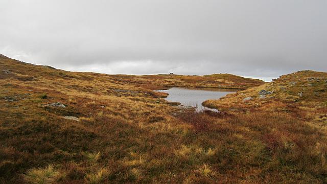 Photo could not load
G9589 : Lochan, Croaghgorm
Richard Webb
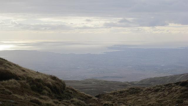 Photo could not load
G9489 : View from Croaghgorm
Richard Webb
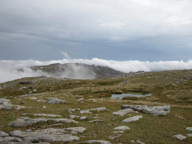 Photo could not load
G9489 : View from Croaghgorm
John Cromie
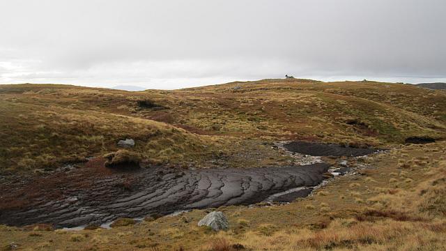 Photo could not load
G9489 : Exposed peat, Croaghgorm
Richard Webb
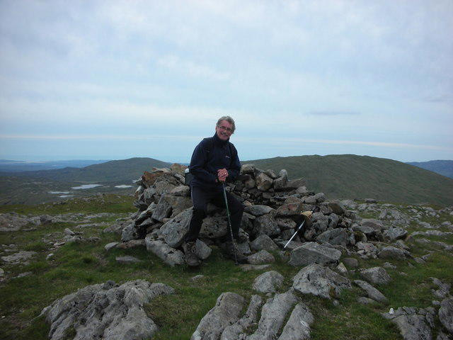 Photo could not load
G9489 : Donegal. "Blue Stack Summit" Taking A Well Earned Rest.
Michael Murtagh
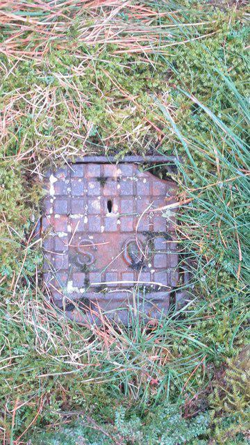 Photo could not load
G9489 : Croaghgorm: The trig point
Richard Webb
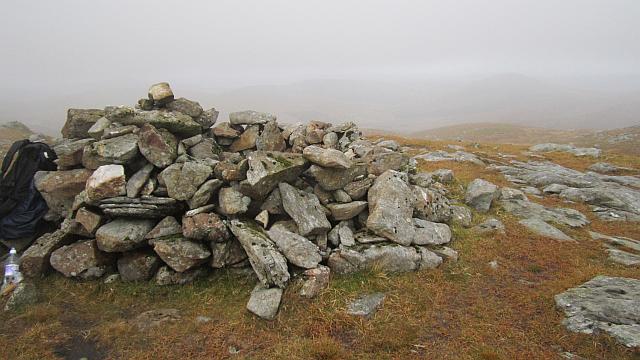 Photo could not load
G9489 : An Chruach Ghorm / Croaghgorm summit
Richard Webb
Hill facts and local notes
Classifications
Elevation
674m
2,211 ft
Prominence
522m
Coordinates
54.7542, -8.0811
G948895
OS Map
11
At the Summit
The summit is adorned with a well-constructed cairn and offers a breathtaking panoramic view of the surrounding mountains and valleys.
Terrain & Geology
Predominantly composed of granite, with underlying schist and gneiss, Croaghgorm showcases the rugged landscape typical of the Bluestack range.
Views & Scenery
From the summit, enjoy stunning views of the surrounding Bluestack Mountains, Lough Eske, and on a clear day, the Atlantic coastline can be spotted.
History & Heritage
Name Origin
An Chruach Ghorm translates to 'the blue hill', reflecting the hill's distinct bluish hue in certain lights.
Historical Significance
Croaghgorm has historical significance tied to local folklore, often featured in stories of the ancient peoples of Donegal.
Getting There & Facilities
Parking
Parking is available at the Peters Hill trailhead, which has space for several vehicles.
Public Transport
Limited bus services run from Donegal Town to areas nearby; it's advisable to check the latest schedules.
Nearby Facilities
There are no facilities on the mountain; however, Donegal Town has cafes, shops and public toilets.
Safety Information
Known Hazards
- Boggy ground can be treacherous; always stick to marked paths. Be wary of weather changes, as conditions can shift swiftly in the mountains.
General Safety Tips
- Check weather conditions before setting out
- Carry appropriate clothing and equipment
- Let someone know your planned route
- Take a map, compass, and GPS device
- Carry emergency supplies: food, water, first aid kit, torch
Hills
Some common questions about the hills answered
Are there group walks up Croaghgorm [Bluestack] [An Chruach Ghorm]?
Many walkers use Walkmates to join or organise walks with others. You can check for group walks around Croaghgorm [Bluestack] [An Chruach Ghorm] through the maps
Are there other walkers around Croaghgorm [Bluestack] [An Chruach Ghorm]?
Activity varies by location and time, but Walkmates lets you see whether others have shared walks or shown interest in this area. Find other people through the walking friends search walking friends for Croaghgorm [Bluestack] [An Chruach Ghorm] search or of course create your own walk for Croaghgorm [Bluestack] [An Chruach Ghorm]
Can I organise a walk to Croaghgorm [Bluestack] [An Chruach Ghorm]?
Yes. If there aren’t any walks listed already, you can create a walk and make it available for others to join.
If you're signed up to Walkmates, you can create a walk to Croaghgorm [Bluestack] [An Chruach Ghorm].
How do I find a walk up this hill?
There are often multiple ways to walk this hill, depending on experience and route preference. Walkmates helps you explore walks and routes that others have shared.
Can I suggest a new route up Croaghgorm [Bluestack] [An Chruach Ghorm]?
Yes. You can suggest or create routes to share with others. Walkmates focuses on the social side of walking, so routes are used to help people organise walks and explore areas together, rather than as detailed navigation tools or route libraries.
Other uses really appreciate knowledgeable walkers sharing their routes. Share your favourite route to Croaghgorm [Bluestack] [An Chruach Ghorm] here
The is an error or something incorrect about this hill. How do I let you know?
We always strive to keep the information on Walkmates as accurate as possible. If you find an error, please let us know through the contact form and we'll aim to correct it as quickly as possible
Community Discussion
Comments
Location
![Croaghgorm [Bluestack] [An Chruach Ghorm] location map](https://cdn.walkmates.com/hill-maps/hill-sources/20125/54.75415_-8.08109.png)
Grid reference: G948895
View on OpenStreetMapOpens a map in a new tab, centred on the hill.
No comments yet. Be the first.